
Carnation 🇺🇸
-
Nautical Twilight begins:04:21 amSunrise:05:41 am
-
Sunset:08:27 pmNautical Twilight ends:09:48 pm
-
Moonrise:04:52 am
-
Moonset:07:08 pm
-
Moon over:12:00 pm
-
Moon under:11:49 pm
-
Visibility:3%
-
 New Moon
-
Distance to earth:366,604 kmProximity:91.8 %
Moon Phases for Carnation
-
excellent Day
-
minor Time:03:52 am - 05:52 am
-
major Time:11:00 am - 01:00 pm
-
minor Time:06:08 pm - 08:08 pm
-
major Time:10:49 pm - 12:49 am
Tide Clock
Tide Graph
Times
| Tide | Time | Height |
|---|---|---|
| high | 03:35 am | 11.88 ft |
| low | 10:26 am | -0.52 ft |
| high | 05:07 pm | 10.66 ft |
| low | 10:29 pm | 4.59 ft |
| Date | Major Bite Times | Minor Bite Times | Sun | Moon | Moonphase | Tide Times |
|---|---|---|---|---|---|---|
|
Mon, 06 May
|
11:00 am -
01:00 pm
10:49 pm -
12:49 am
|
03:52 am -
05:52 am
06:08 pm -
08:08 pm
|
R: 05:41 am S: 08:27 pm |
R: 04:52 am S: 07:08 pm |
New Moon |
high: 03:35 am
, 11.88 ft
, Coeff: 99
low: 10:26 am
, -0.52 ft
high: 05:07 pm
, 10.66 ft
, Coeff: 81
low: 10:29 pm
, 4.59 ft
|
|
Tue, 07 May
|
11:53 am -
01:53 pm
11:40 pm -
01:40 am
|
04:13 am -
06:13 am
07:34 pm -
09:34 pm
|
R: 05:40 am S: 08:29 pm |
R: 05:13 am S: 08:34 pm |
New Moon |
high: 04:08 am
, 11.81 ft
, Coeff: 98
low: 11:06 am
, -1.84 ft
high: 06:06 pm
, 11.38 ft
, Coeff: 92
low: 11:21 pm
, 5.48 ft
|
|
Wed, 08 May
|
12:32 am -
02:32 am
12:49 pm -
02:49 pm
|
04:39 am -
06:39 am
08:59 pm -
10:59 pm
|
R: 05:38 am S: 08:30 pm |
R: 05:39 am S: 09:59 pm |
New Moon |
high: 04:42 am
, 11.65 ft
, Coeff: 96
low: 11:47 am
, -2.66 ft
high: 07:01 pm
, 11.84 ft
, Coeff: 99
|
|
Thu, 09 May
|
01:22 am -
03:22 am
01:45 pm -
03:45 pm
|
05:12 am -
07:12 am
10:18 pm -
12:18 am
|
R: 05:37 am S: 08:31 pm |
R: 06:12 am S: 11:18 pm |
New Moon |
low: 12:11 am
, 6.27 ft
high: 05:16 am
, 11.38 ft
, Coeff: 92
low: 12:29 pm
, -2.99 ft
high: 07:54 pm
, 12.01 ft
, Coeff: 101
|
|
Fri, 10 May
|
02:13 am -
04:13 am
02:41 pm -
04:41 pm
|
05:57 am -
07:57 am
11:25 pm -
01:25 am
|
R: 05:35 am S: 08:33 pm |
R: 06:57 am S: - |
Waxing Crescent |
low: 01:01 am
, 6.86 ft
high: 05:53 am
, 10.93 ft
, Coeff: 85
low: 01:12 pm
, -2.82 ft
high: 08:48 pm
, 11.98 ft
, Coeff: 101
|
|
Sat, 11 May
|
03:09 am -
05:09 am
03:42 pm -
05:42 pm
|
06:53 am -
08:53 am
11:25 pm -
01:25 am
|
R: 05:34 am S: 08:34 pm |
R: 07:53 am S: 12:25 am |
Waxing Crescent |
low: 01:54 am
, 7.28 ft
high: 06:32 am
, 10.37 ft
, Coeff: 76
low: 01:57 pm
, -2.26 ft
high: 09:43 pm
, 11.78 ft
, Coeff: 98
|
|
Sun, 12 May
|
04:08 am -
06:08 am
04:44 pm -
06:44 pm
|
12:17 am -
02:17 am
07:59 am -
09:59 am
|
R: 05:33 am S: 08:35 pm |
R: 08:59 am S: 01:17 am |
Waxing Crescent |
low: 02:54 am
, 7.51 ft
high: 07:15 am
, 9.65 ft
, Coeff: 66
low: 02:44 pm
, -1.41 ft
high: 10:39 pm
, 11.55 ft
, Coeff: 94
|


uploaded by: Dezzi23

uploaded by: Sledhead84

uploaded by: Terry Foster

uploaded by: Mick.e

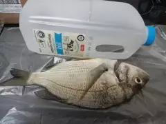
uploaded by: Mick.e

uploaded by: Mick.e

uploaded by: Andretheone

uploaded by: John Needham

uploaded by: Lee Smith 1

uploaded by: D2Turnt
Best Fishing Spots in the greater Carnation area
Beaches and Bays are ideal places for land-based fishing. If the beach is shallow and the water is clear then twilight times are usually the best times, especially when they coincide with a major or minor fishing time. Often the points on either side of a beach are the best spots. Or if the beach is large then look for irregularities in the breaking waves, indicating sandbanks and holes. We found 2 beaches and bays in this area.
Alexander Beach - 14km , Rosemont Beach - 14km
We found a total of 87 potential fishing spots nearby Carnation. Below you can find them organized on a map. Points, Headlands, Reefs, Islands, Channels, etc can all be productive fishing spots. As these are user submitted spots, there might be some errors in the exact location. You also need to cross check local fishing regulations. Some of the spots might be in or around marine reserves or other locations that cannot be fished. If you click on a location marker it will bring up some details and a quick link to google search, satellite maps and fishing times. Tip: Click/Tap on a new area to load more fishing spots.
Horseshoe Lake - 2km , Langlois Lake - 2km , Ames Lake - 3km , Green Slough - 3km , Horseshoe Slough - 3km , Ames Lake Pothole - 4km , Lake Marcel Dam - 5km , Lake Marcel - 5km , Sikes Lake - 5km , Stickney Slough - 5km , Janicke Slough - 6km , Lake Joy - 6km , Moss Lake - 7km , Allen Lake - 8km , Peterson Pond Dam - 8km , Rutherford Slough - 8km , Beaver Lake - 9km , Beaver Lakes - 9km , Hull Lake - 9km , Sawns Mill Pond Dam - 9km , Todd Lake - 9km , Novelty Bridge - 9km , Long Lake - 10km , Loutsis Dam - 10km , Lake Marie - 10km , Rasmussen Lake - 11km , Tolt River Regulating Basin South Dam - 11km , Tolt River Regulating Basin West Dam - 11km , Yellow Lake - 11km , Kings Lake - 12km , Laughing Jacobs Lake - 12km , O'Brians Lake - 12km , Obrien Dam - 12km , Pine Lake - 12km , Lake Alice - 13km , Boyle Lake - 13km , Bridges Lake - 13km , Lake Margaret Dam - 13km , Mud Lake - 13km , Redmond Reservoir Dam - 13km , Snoqualmie Diversion Dam - 13km , Weber Point - 13km , Welcome Lake Dam - 13km , Alexander Beach - 14km , Black Lake - 14km , Jensens Cove - 14km , Klaus Lake - 14km , Pattie Prince Dam - 14km , Preston Mill Pond Dam - 14km , Rosemont Beach - 14km , Lake Sammamish - 14km , Soup Hole - 14km , Snoqualmie River Bridge - 14km , Borst Lake - 15km , Cherry Lake - 15km , Drunken Charlie Lake - 15km , Fury Lake - 15km , Lakes Unlimited Dam - 15km , Maud Lake - 15km , Round Lake - 15km , Snoqualmie Mill Pond Dam - 15km , Sulphur Springs Point - 15km , Tradition Lake - 15km , Trestle Swamp - 15km , Echo Lake Dam - 16km , Greenwood Point - 16km , Lynch Lake - 16km , Meadowbrook Slough - 16km , Treen Lake - 16km , Tuck Lake Dam - 16km , Johnsons Swamp - 17km , McLeod Lake - 17km , Bengston Lake - 18km , Cottage Lake - 18km , Lake Hannan - 18km , King Lake - 18km , Paradise Lake - 18km , Reid Slough - 18km , Cedar Ponds Lake - 19km , Crescent Lake - 19km , Devils Lake - 19km , Echo Lake - 19km , Lake Fontal - 19km , High Bridge - 19km , Crater Lake - 20km , Crystal Lake Dam - 20km , Lake Elsie - 20km
Comments